Na Pali Coast Guide: Viewpoints, Hikes And Boat Or Air
Sixteen miles of cliffs, empty valleys and sea caves make the Na Pali Coast the single most photographed stretch of Kauai. This guide covers what it is, how ground access stands after Hurricane Lowell, and how each way of seeing it compares.
Short answer
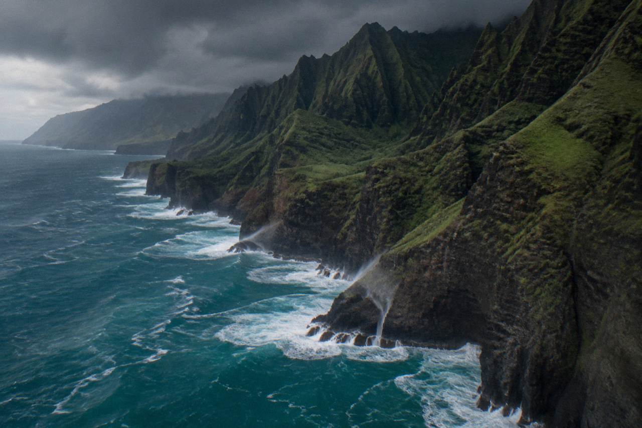
The Na Pali Coast is a 16-mile stretch of cliffs up to 4,000 feet high on Kauai's northwest shore. After Hurricane Lowell, DLNR lands including Haena and the Kalalau Trail were closed and access follows DLNR notices. A flight from Lihue or Princeville is the one way to see the whole coast, from $336 per person.
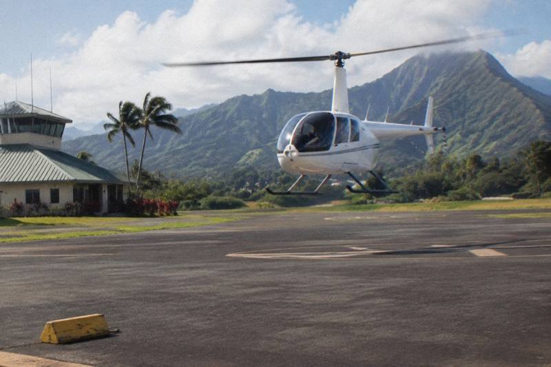
The Na Pali Coast is the reason many people book a Kauai trip at all. Sixteen miles of near-vertical green cliffs, hanging valleys and sea caves line the island's northwest shore, and almost none of it has a road. You can see fragments of it from two or three drive-up lookouts, walk pieces of it on a famous trail, or try to reach it by sea. Or you can see all of it in under an hour from a helicopter, which is why this site exists: the 50-minute shared eco flight from Lihue is the most-reviewed tour on our roster, with 2,065 reviews at 4.8, and it runs the full coastline on its loop of the island. If you're curious how this stretch of shoreline earned such a reputation, why the Na Pali Coast became so famous explains the full backstory.
There is a wrinkle this year, and this guide will not hide it. Hurricane Lowell moved across Kauai in September 2026, and the DLNR notice that followed closed DLNR lands on the island, including Haena, the Kalalau Trail and the Kokee side of the canyon. Access follows DLNR notices, and we link them below. What that means for each way of seeing Na Pali, ground, sea and air, is laid out section by section here.
What Is The Na Pali Coast And Why Is It So Famous?
The Na Pali Coast is a 16-mile stretch of coastline on Kauai's northwest shore, running from Polihale Beach in the west to Kee Beach in the east, with cliffs that rise as much as 4,000 feet above the sea. Hawaii State Parks manages it as a state wilderness park, and no road touches any of it, which is the entire reason it still looks the way it does. Its name means "the cliffs" in Hawaiian.
The scale is the part that surprises people. These are not headlands; they are the eroded outer wall of an ancient volcano, cut by valleys that each end in a stream and a pocket beach. The valleys, Hanakapiai, Kalalau, Nualolo and Honopu among them, were farmed and lived in for centuries, and the remains of terraces are still visible in Kalalau. The trail that connects them was the footpath between communities before boats and aircraft existed.
Fame did the rest. The coast has appeared in films for decades, and its sea cliffs, arches and the isolated Honopu Beach are among the most published images of Hawaii. Readers curious about the film history can follow that thread separately; the practical question for a trip planner is simpler, and it is the one the rest of this guide answers: given current access, what are your realistic ways of seeing it?
| Feature | Figure | Source basis |
|---|---|---|
| Length of coastline | 16 miles | Hawaii State Parks |
| Maximum cliff height | About 4,000 ft | Hawaii State Parks |
| Western end | Polihale Beach | Hawaii State Parks |
| Eastern end | Kee Beach | Hawaii State Parks |
| Managing agency | Hawaii State Parks (DLNR) | Hawaii State Parks |
The official park page at Hawaii State Parks carries the park's own description and boundaries, and it is the right first stop for anyone weighing a ground visit.
Where Can You See The Na Pali Coast From The Ground?
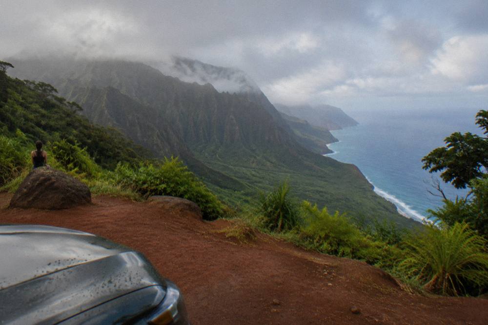
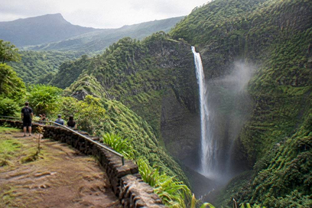
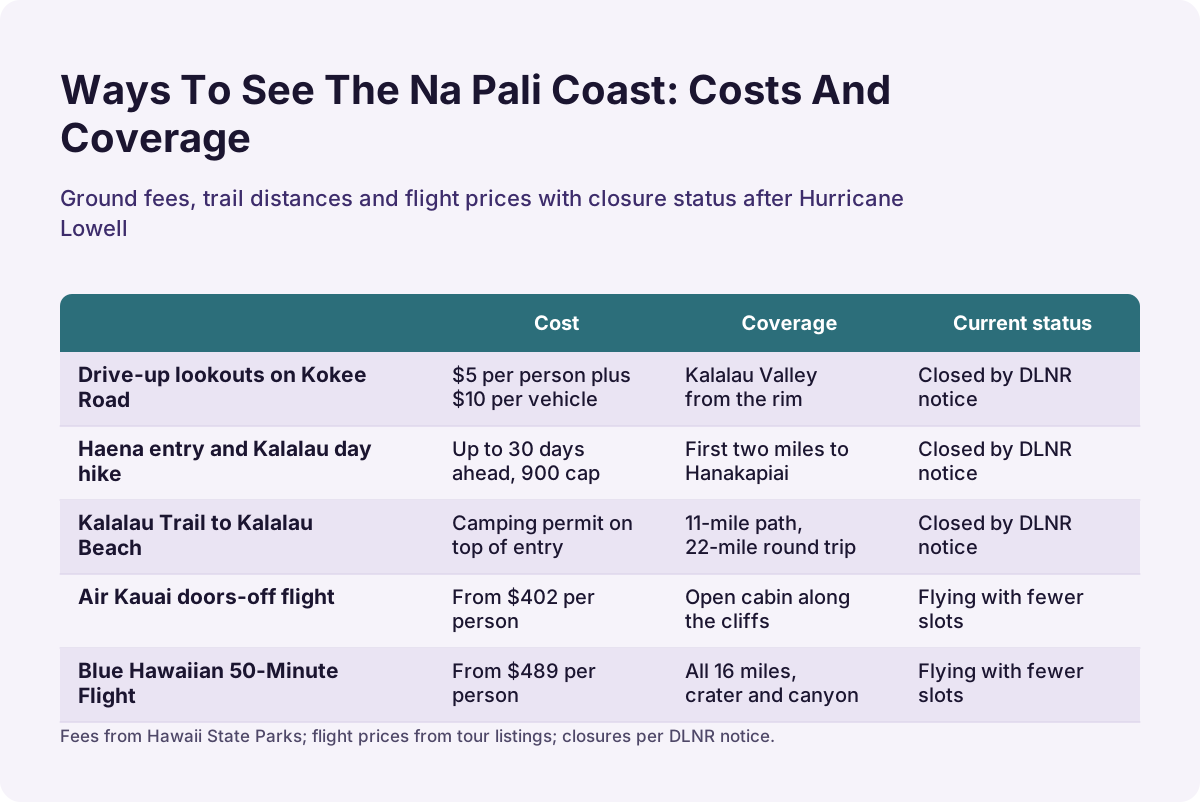
Two drive-up lookouts give a genuine Na Pali view without setting foot on a trail: Kalalau Lookout and Puu o Kila, both reached by Kokee Road above Waimea Canyon, at mile markers 18 and 19. Both sit inside DLNR park land, and after Hurricane Lowell the DLNR notice closed Kokee Road and Kokee State Park, so access follows DLNR notices and no reopening date has been given. Until then, treat every ground viewpoint as conditional.
When the road is passable, the lookouts are straightforward: you drive up from Waimea, pay the non-resident entry fee of $5 per person plus $10 per vehicle, and one ticket covers both Waimea Canyon and Kokee. The view from Kalalau Lookout looks straight down the Kalalau Valley to the sea, roughly a mile below the rim, and it is the single best free-standing Na Pali view on the island. Our Waimea Canyon State Park guide covers the drive, the fee kiosks and every lookout in detail.
Polihale Beach at the coast's western end is the other ground option, a long sand beach backed by dunes at the end of a rough dirt track. It is also DLNR land, and it was included in the closure. Kee Beach at the eastern end sits inside Haena State Park, which needs an advance reservation system even in normal times, and Haena was closed by the same notice. In short: every ground angle on this coast runs through DLNR land, and DLNR controls the timing. The department's notices at dlnr.hawaii.gov are the authoritative word on when any of it reopens.
That single fact is why the air matters so much this year. If your trip falls in the next few months, the flights below are the versions of Na Pali you can actually book with confidence.
Can You Hike The Na Pali Coast?
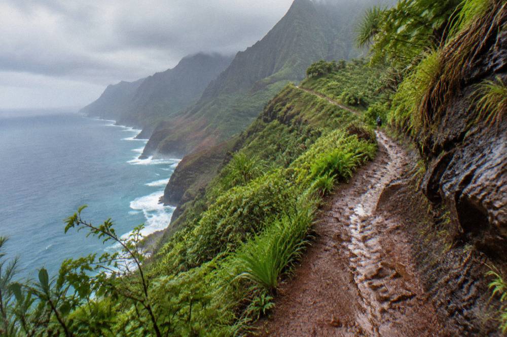
The Kalalau Trail is the coast's only land route, an 11-mile coastal path from Kee Beach to Kalalau Beach, and reaching the far end has always required a camping permit on top of Haena State Park entry. After Hurricane Lowell, DLNR closed Haena and the trail with the rest of its Kauai lands, so no hike is currently bookable and access follows DLNR notices. Do not plan a trip around this trail without checking first.
In normal conditions the rules are layered. Haena State Park requires an advance reservation through its official system, released up to 30 days ahead, with no same-day sales, and a daily visitor cap of 900 people. Day hikers walk the first two miles to Hanakapiai Beach and stream; the stretch beyond Hanakapiai to Kalalau additionally requires a Napali Coast camping permit. The full 22-mile round trip to Kalalau and back is a two-day undertaking with a campsite at the far end, not a day hike, and the trail's stream crossings and narrow ledges are the reason seasoned hikers treat it with respect.
The honest planning advice for now is to build a trip that works without the trail and treats a reopening as a bonus. Hikers who want a deeper dive into the trail's permit system and history can read our Na Pali Coast helicopter tour guide, which covers the same coastline from the air, and our best time to visit Kauai guide for how seasons shift both hiking and flying conditions. If the trail reopens before your dates, the reservation systems snap back into place exactly as before; nothing about the hurricane changed the permit structure, only the access.
This is the moment to say plainly what this site is for. When ground access is conditional, a flight is the one version of Na Pali that does not depend on a trailhead, a reservation calendar or a road clearing. The featured tour on this page, the Blue Hawaiian 50-Minute Flight, runs the coast as part of its island loop, from $489 per person, and you can check the eco adventure tour's listing alongside the comparison further down.
Can You Reach The Na Pali Coast By Boat?
Boat tours normally run the coast from Port Allen on the south shore, and in a normal year they are a real alternative to flying. After Hurricane Lowell, a local recovery report said Na Pali boat tours were still off even as Port Allen harbor reopened, and reports said tour departures remained unsettled. Nothing on this page should be read as a promise that any boat is running; check the operator's live listing before you count on it.
The boat experience, when it runs, is the inverse of the flight: slow, at water level, close enough to hear surf in the sea caves, with snorkeling stops in season. It is also the version most exposed to summer swell and winter waves, since the coast's exposure to open ocean is exactly what makes it dramatic. Our full comparison of the two, including motion sickness, cost per minute and what each one shows best, lives in the helicopter versus Na Pali boat tour guide.
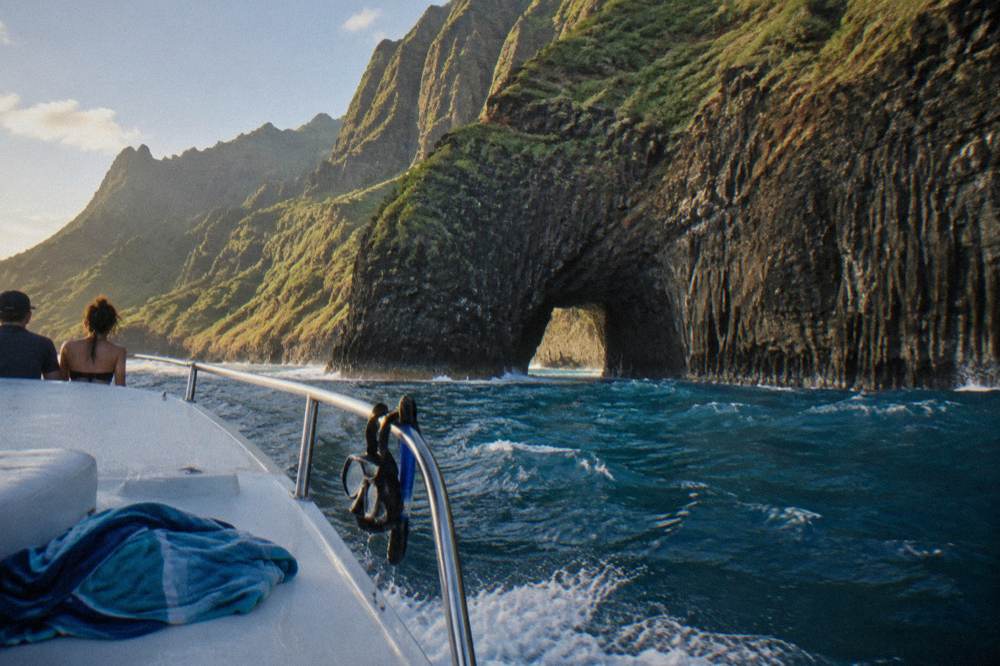
One structural point is worth knowing when you weigh the two. A boat enters the coast from the western end and turns back partway along, because the sea state near the trailheads and the reserve zones limits how far it goes. A helicopter traces the whole 16 miles and adds the interior, the Waialeale crater and Waimea Canyon, in the same hour. Neither is "better"; they answer different questions, and many travelers who can afford both do both. But in a year when the boat calendar is in question and the trails are closed, the air is where the reliable version of this coast lives.
For travelers who want the air version with the wind in the cabin, the Air Kauai doors-off flight is the roster's most-reviewed doors-off option, 4.8 from 545 reviews, from $402 per person, and it runs the coastline with nothing between you and the cliffs but air.
Why The Air Is The One Way To See The Whole Coast
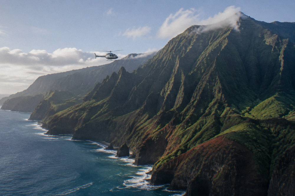
A helicopter sees all 16 miles of Na Pali in a single continuous pass, plus the interior valleys, the Waialeale crater and Waimea Canyon that no boat or trail reaches in one outing, and it does so regardless of trail closures, reservation calendars and harbor status. Reports after Hurricane Lowell said Lihue flights were flying with fewer slots than usual, so the advice is to book early and read the live listing, not to assume any departure is guaranteed.
The math is not subtle. The coast is 16 miles long with a road at neither end. A flight from Lihue reaches the coastline within minutes of leaving the heliport, follows the cliffs past Kalalau Valley and Honopu, then swings inland to the wettest place on the island before returning over the canyon. The Blue Hawaiian 50-Minute Flight, the featured tour on this page, covers exactly that loop, from $489 per person, with free cancellation up to 24 hours before the start time. One guest review on the listing calls it a "Must do experience, such a diverse island that can really only be appreciated by air."
Weather still rules. The same cliffs that make the coast famous catch the trade winds and the clouds, and operators reschedule or refund when a flight cannot run safely. Every listing on this roster states free cancellation up to 24 hours before the start time, and weather cancellations are rescheduled or refunded per the operators. The practical pattern that works: book the earliest workable morning slot, because mornings generally bring the calmest winds, and keep one backup morning later in your trip. Our best time of day for a Kauai helicopter tour guide walks through that in detail.
The FAA frames the safety side of all this: Hawaii air tours operate under 14 CFR Part 136, which sets a 1,500-foot minimum altitude above the surface, requires a performance plan before each flight, flotation gear for segments beyond the shore, and a ditching briefing for every passenger. Our Kauai helicopter safety guide explains what those rules mean for you in the cabin.
For a small-group version of the same coast, Jack Harter's MD500 doors-off flight carries at most four passengers, 4.8 from 425 reviews, from $460 per person, with the pilot narrating canyons, falls and shore.
Which Flight Best Fits A Na Pali Coast Visit?
Three listings cover the coast for three situations: the Blue Hawaiian 50-Minute Flight for the classic full-island loop from Lihue, the Discover Kauai flight from Princeville for a north-shore departure closer to the coast, and the private doors-off Ultimate Waterfalls flight for travelers who want no strangers in the cabin. All three carry free cancellation up to 24 hours before the start time, and prices run from $489, $579 and $425 per person respectively.
The comparison that matters is not price alone; it is departure point and cabin. The Princeville departure, 45 minutes in a cabin of up to four, reaches the coast minutes after takeoff and suits anyone staying on the north shore, at 4.9 from 34 reviews. The private doors-off flight from Ali'i Kauai, 75 minutes with a minimum of two paying passengers, at 5.0 from 1,794 reviews, is the one where nobody sits in a middle seat and the doors come off over the falls. A guest review on that listing calls it a "Once in a lifetime experience! Breathtaking views."
| Flight | Departure | Duration | From (per person) | Rating and reviews | Cabin |
|---|---|---|---|---|---|
| Blue Hawaiian 50-Minute Flight | Lihue Airport heliport | 50 min | $489 | 4.8 from 2,065 | Shared, up to 6 |
| Discover Kauai from Princeville | Princeville Airport | 45 min | $579 | 4.9 from 34 | Shared, up to 4 |
| Private Doors-Off Ultimate Waterfalls | Lihue Commuter Terminal | 1 hr 15 min | $425 | 5.0 from 1,794 | Private, min 2 |
| Air Kauai Doors-Off Adventure | Lihue Airport heliport | 50 min | $402 | 4.8 from 545 | Shared, up to 6 |
| Canyon Rim Landing flight | Safari office, Lihue | 1 hr 30 min | $396 | 4.8 from 392 | Shared, up to 6 |
One more option belongs in this table even though its landing is the headline: Safari's 90-minute flight sets down on the rim of Olokele Canyon for a walk-around before continuing over Na Pali and Waimea Canyon, from $396 per person, 4.8 from 392 reviews. Note what it is not: the landing is at the canyon rim, not at Manawaiopuna Falls, and no tour on this roster lands at the falls. Our Jurassic Falls helicopter landing tour guide explains that distinction and what the falls look like from the air.
When Is The Best Time Of Year For Na Pali Views?
Summer, roughly May through September, offers the most reliable conditions on this coast, with lighter winds, less cloud over the cliffs and calmer near-shore water, while winter brings bigger surf, more rain on the north shore and the highest chance a flight gets rescheduled. Lihue's recorded monthly rainfall bottoms out in June and July at 1.79 and 1.75 inches, against 5.61 inches in March.
The rainfall numbers are worth internalizing, because they explain the coast's look as well as its weather. The wettest month on record for Lihue is March, the driest are midsummer, and the interior around Waialeale takes about 450 inches of rain a year, which is why the valleys are green to the waterline. Winter on the north shore also means surf of 6 to 15 feet and above, which matters for boats far more than for aircraft.
| Month | Lihue rainfall (in) | Average high (F) | Notes for the coast |
|---|---|---|---|
| Jan | 2.78 | 78.6 | Winter surf on the north shore |
| Feb | 3.63 | 78.1 | Winter surf, mixed flying weather |
| Mar | 5.61 | 78.5 | Wettest month in the record |
| Apr | 2.03 | 79.8 | Rain drops, shoulder season begins |
| May | 2.18 | 81.6 | Summer pattern starts, calmer seas |
| Jun | 1.79 | 83.3 | Among the driest, strong visibility |
| Jul | 1.75 | 84.6 | Driest month in the record |
| Aug | 2.33 | 85.2 | Warm, generally reliable |
| Sep | 2.18 | 85.3 | Warm, watch storm season instead |
| Oct | 3.27 | 83.9 | Rain picks up, winter surf returns |
| Nov | 4.03 | 81.2 | Wetter, fewer crowds |
| Dec | 4.64 | 79.1 | Wet, winter surf at its peak |
Two caveats keep this honest. Storm season, roughly June through November, occasionally overrides the pattern, as Hurricane Lowell proved in September 2026. And the interior weather you see from the air does not always match the beach weather you feel at your hotel; a coast that looks cloud-capped from Kee can be clear from 1,500 feet above it. Operators make the call flight by flight, and every listing here reschedules or refunds when they do.
What Do The Closures Mean For Your Na Pali Coast Plans?
Plan around three facts. First, DLNR lands on Kauai, including Haena, the Kalalau Trail, Kokee and the Waimea Canyon lookouts, were closed after Hurricane Lowell, and access follows DLNR notices with no reopening date given. Second, reports said Lihue helicopter tours were flying, with fewer slots than usual. Third, every flight listing on this roster carries free cancellation up to 24 hours before the start time, so booking a flight early costs you nothing if your plans shift.
The practical build for a trip in the months ahead, then, looks like this. Book a flight first, in a morning slot, with a backup morning later in the week. Treat the lookouts, the trail and the boat as options that may come back online, and check DLNR's notices the week you travel. Keep a flexible day for the north shore either way: beaches are public in Hawaii, and the coastline between Kealia and Hanalei gives you ocean time that no closure touches.
And keep the perspective the coast itself offers. Whether you stand at a lookout rim, ride a boat through a sea cave, or fly the whole thing in an hour, you are seeing the same 16 miles of the same ancient volcano wall. The air is simply the version that shows you all of it at once, and this site, Helicopter Tours Kauai, exists to help you pick that flight with honest numbers rather than brochure language. Our Kauai helicopter tour routes guide maps each listing's path across the island if you want to compare exactly what each one flies over.
Common Questions About The Na Pali Coast
What Is The Na Pali Coast?
A 16-mile stretch of cliffs and valleys on Kauai's northwest shore, running from Polihale Beach to Kee Beach, with cliffs rising as much as 4,000 feet above the sea. Hawaii State Parks manages it as a wilderness park, and no road reaches any part of it.
Can You Hike The Na Pali Coast Right Now?
The Kalalau Trail was closed along with the rest of Kauai's DLNR lands after Hurricane Lowell, and access follows DLNR notices. In normal times the trail requires a Haena State Park reservation plus a camping permit for the stretch beyond Hanakapiai. Check the DLNR notices before planning any hike.
Can You See Na Pali Without Hiking?
Yes, three ways. The Kalalau and Puu o Kila lookouts above Waimea Canyon give the classic view, when the road and park are open per DLNR notices. Boat tours run the coast from Port Allen when conditions allow. And helicopter flights from Lihue or Princeville cover all 16 miles in under an hour.
Is A Helicopter Or A Boat Better For Seeing Na Pali?
They answer different questions. A boat gets you close to sea caves and snorkeling spots but covers part of the coast. A helicopter covers all 16 miles plus the interior crater and canyon in one flight, regardless of trail status. Many travelers do both; in a year of closures and unsettled boat schedules, the flight is the dependable one.
How Much Does A Na Pali Coast Helicopter Flight Cost?
On this roster, shared flights that include the coast run from $336 to $579 per person depending on duration and departure point, and private doors-off flights run from $384 to $425 per person. Prices vary by date, so always check the live listing for the day you want.
Do Na Pali Flights Get Cancelled For Weather?
Yes, and the operators say so plainly. Trade winds and cloud over the cliffs cause reschedules, especially later in the day. Every listing on this roster offers free cancellation up to 24 hours before the start time, and weather cancellations are rescheduled or refunded per the operators.