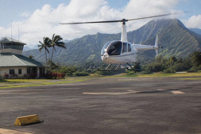
Why Is The Na Pali Coast So Famous?
The Na Pali Coast on Kauai runs 16 miles with cliffs rising as much as 4,000 feet, with no road and no landing strip. Here is why it became famous and how people see it today.
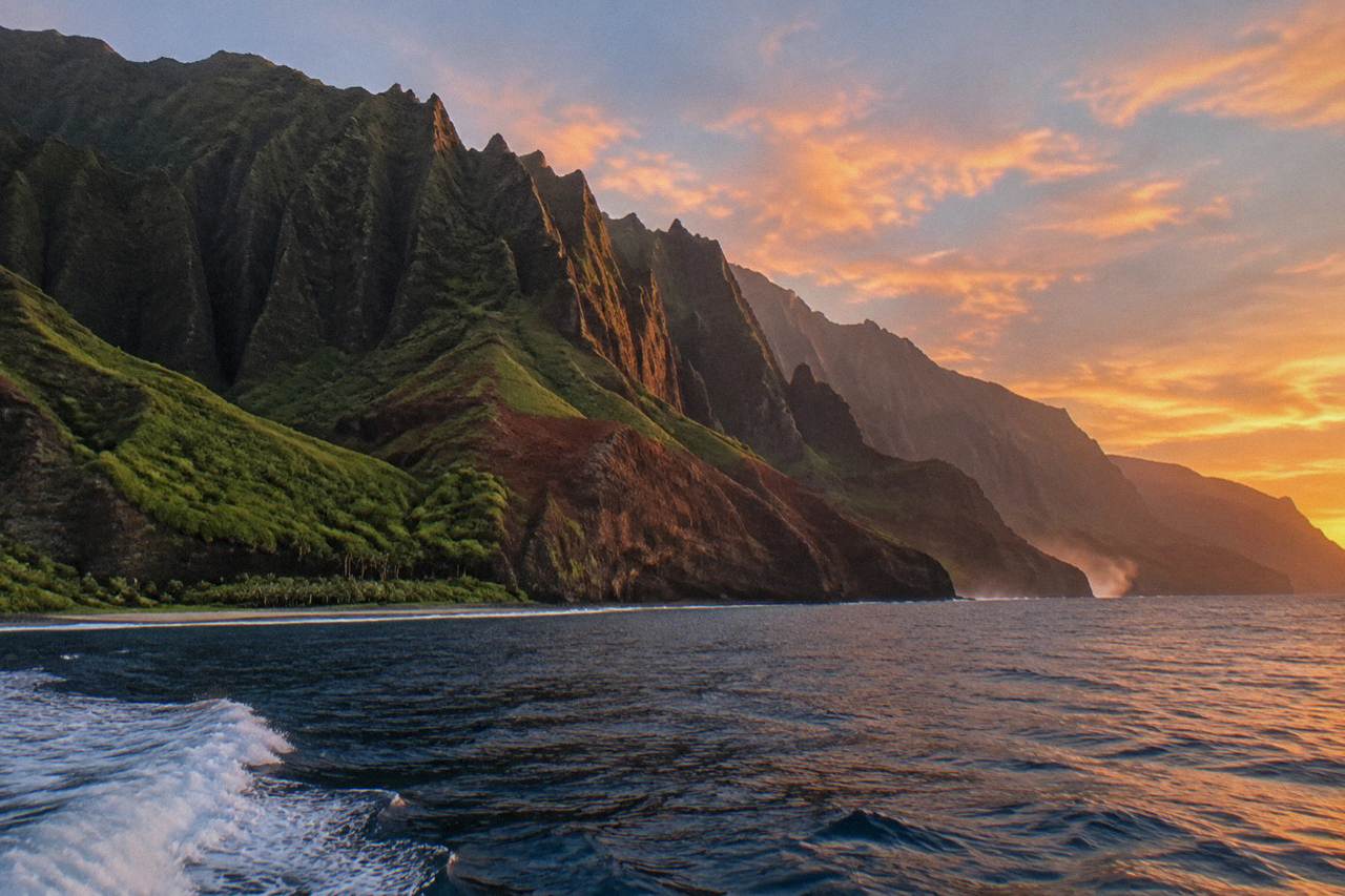
The Na Pali Coast is a 16-mile stretch of northwest Kauai running from Polihale Beach in the west to Kee Beach in the east, with cliffs that tower as much as 4,000 feet above sea level, according to Hawaii State Parks. No road reaches it, no road crosses it, and the only land route in, the Kalalau Trail, is a permit-and-reservation corridor through Haena State Park whose access follows state notices. That combination of scale and inaccessibility is the short answer to why it became famous. The longer answer involves rain, geology, Hollywood and a slow-moving argument about how many people should be allowed to look at it at once.
Why Is The Na Pali Coast So Famous?
The Na Pali Coast is famous because it is a 16-mile line of cliffs up to 4,000 feet high that no road ever conquered. The northwest shore was carved by rain, and the result is a wall of green amphitheater valleys seen in full only from the air or the water. Its appearance in major films spread the image worldwide.
Two things stack together here. First, the raw geometry: the Hawaii State Parks page describes a 16-mile stretch with cliffs that tower as much as 4,000 feet above sea level, which puts the Na Pali escarpment in the same conversation as sea cliffs anywhere on the planet. Second, the absence of a road. On an island of 552 square miles that otherwise submits to highways, this one stretch of coast never did, so the views belong to hikers, boaters and flight passengers rather than to windshield tourists.
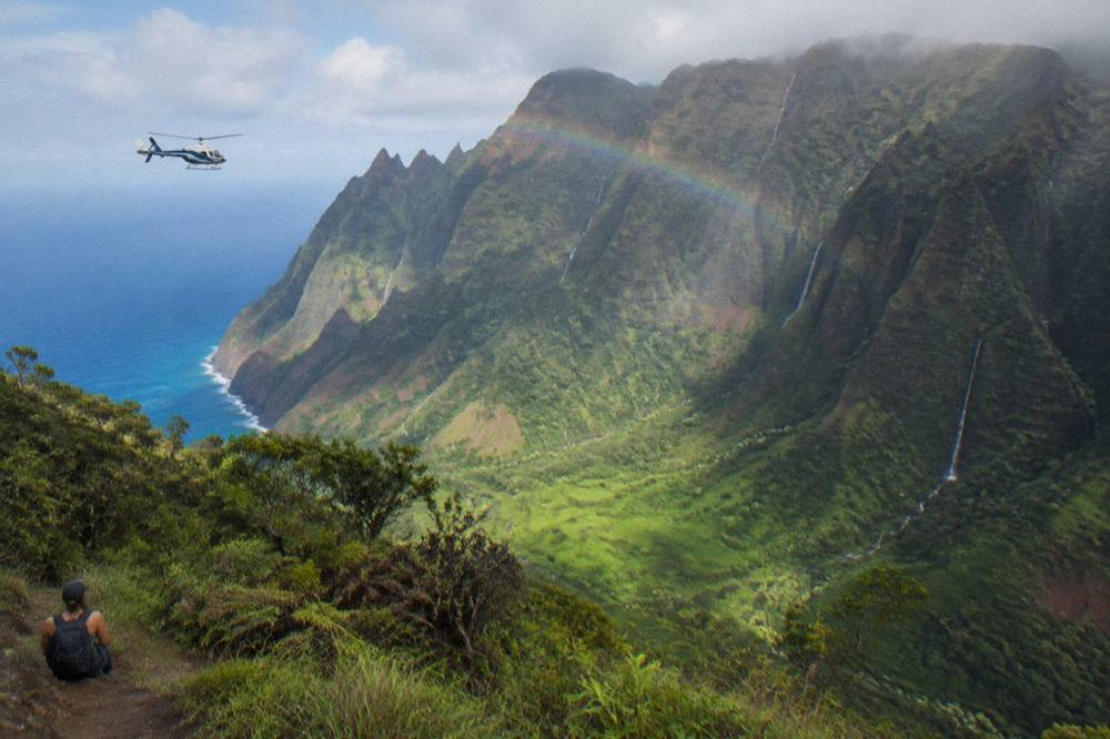
There is also a fourth, quieter reason: the coast behaves like a weather boundary. Trade winds push clouds onto the cliffs and the interior, so the same view can be wall-to-wall green at 9 a.m. and gray at noon, and everyone who has flown it knows the gamble. That variability is exactly why so many travelers now book a flight early in a Kauai trip, keep a weather backup, and treat the Na Pali as the headline rather than a stop. The 50-minute shared eco flight from Lihue, the most-reviewed tour on this site's roster at 4.8 from 2,065 reviews, exists almost entirely because of this coastline.
For readers deciding how to see it, the three listings below cover the main approaches: the full-island shared flight out of Lihue, the small-cabin Princeville departure that starts closer to the cliffs, and a private doors-off flight where every passenger gets a window.
How Tall Are The Na Pali Cliffs And How Long Is The Coast?
The coast runs 16 miles from Polihale Beach in the west to Kee Beach in the east, and the cliffs rise as much as 4,000 feet above sea level, figures published by Hawaii State Parks for Na Pali Coast State Wilderness Park. The valleys between the ridges are steep-walled amphitheaters, several with waterfalls that only run after rain. The scale is the point: this is not a single lookout, it is a continuous wall.
The state parks page frames the coast as a 16-mile stretch extending from Polihale to Kee, and the same park system's trail pages describe cliffs that tower as much as 4,000 feet above sea level. To make that concrete: stacked against the Chicago skyline or a Manhattan supertall, the tallest of these cliff faces would stand roughly level with the roofline. The valleys, Hanakoa, Kalalau, Nualolo and their neighbors, are not gentle notches but collapsed bowls, cut back into the volcano's flank by streams that have had roughly five million years to work, the age commonly given for the Kauai volcano in reference works such as Britannica.
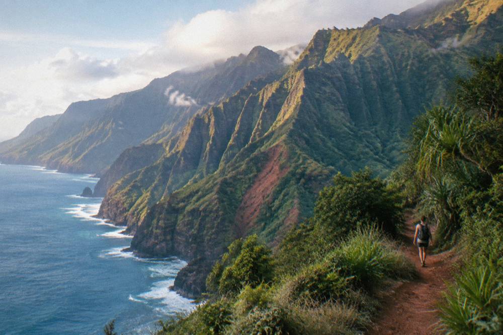
Rainfall is the sculptor. The wet highlands sit only a few miles inland from the coast, so the water arrives fast and leaves vertically. When a flight turns along the coast after rain, passengers routinely count waterfalls that have no name and no trail, because they are temporary, appearing and disappearing with the weather. A guest review of the Blue Hawaiian 50-Minute Flight, the most-reviewed listing on this roster at 4.8 from 2,065 reviews, calls the island "such a diverse island that can really only be appreciated by air," which is a fair summary of why the aerial view became the standard way to take the coast in.
For anyone comparing the numbers side by side, here is what the coast actually measures, using only the state-parks and verified figures.
| Measurement | Figure | Source |
|---|---|---|
| Length of the coast | 16 miles, Polihale Beach to Kee Beach | Hawaii State Parks |
| Maximum cliff height | Up to 4,000 feet above sea level | Hawaii State Parks |
| Waialeale average rainfall | About 450 inches per year | Britannica |
| Kauai island area | 552 square miles | gohawaii.com |
| Island age (volcano) | About 5 million years | Britannica |
If the question on your mind is whether a flight is worth booking for this view alone, the honest framing is that the coast is the single most reliable payoff on any Kauai flight circuit: weather permitting, every standard route from Lihue or Princeville includes it.
Why Is There No Road Along The Na Pali Coast?
No road exists along the Na Pali Coast because the cliffs rise almost directly from the ocean, leaving no coastal shelf to build on, and the engineers of Kauai's highway network routed Kuhio Highway along the east and north shores instead, ending the drivable island at Kee Beach. The coast was never bridged, tunneled or cut, and today it sits inside a state wilderness park that forbids development.
This is the fact that does the most work in the fame story. On Oahu and Maui, famous coastlines came with roads, and the roads delivered the crowds. On Kauai, the northwest shore's wall of pali defeated the road builders entirely, so the only ways in became the Kalalau Trail on foot, the ocean by boat, and the air. The result is a paradox the island has lived with for decades: the most famous view on Kauai is also the least accessible, and the businesses that show it to people, boat operators and helicopter operators alike, cluster at the edges.
The state protected the result. Na Pali Coast State Wilderness Park wraps the whole stretch, which is why no resort, road or landing strip ever appeared inside it. Access rules tightened over the years, especially at the Haena end, where entry now requires an advance reservation through the state's system, released up to 30 days ahead with no same-day sales, and where day access to the trailhead has been capped at a daily visitor limit of 900. Those limits exist precisely because the demand for the coast outran the capacity of a place with one trail and no parking to spare.
It also means the coast's fate is tied to state notices in a way a roadside attraction never is. After Hurricane Lowell in early September 2026, a DLNR notice closed all DLNR lands on Kauai, including Haena and the Kalalau Trail, and reports said road clearing on the canyon side could take many more weeks. Access follows DLNR notices, and the agency's updates are the place to check before planning any ground visit; the department's site is at dlnr.hawaii.gov. Flights, by contrast, were reported still operating from Lihue after the storm, with fewer slots than usual, though any specific flight depends on weather and the operator's schedule.
What Do Films Have To Do With The Na Pali Coast's Fame?
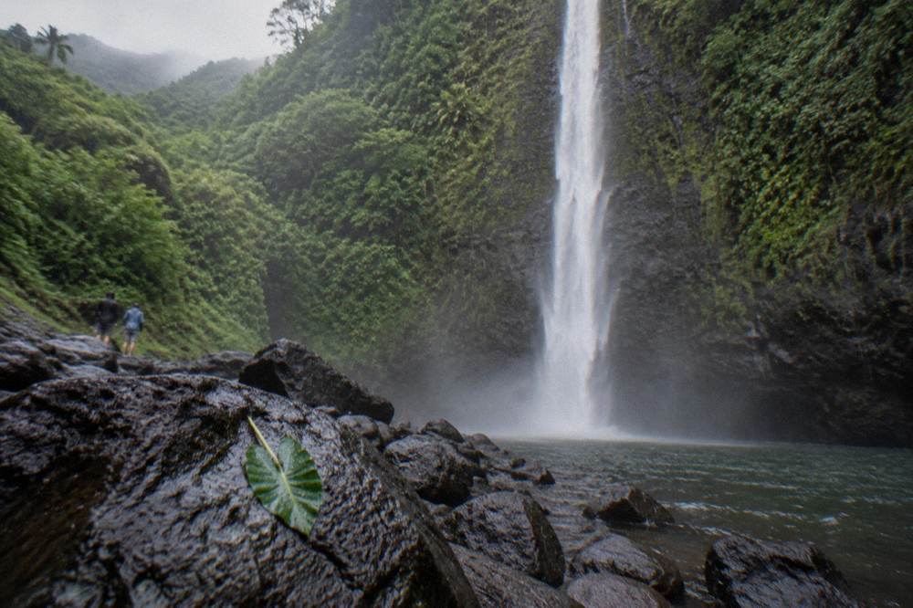
The coast's worldwide recognition owes a lot to cinema, most directly through Kauai's role in Jurassic Park, whose waterfall scenes used Manawaiopuna Falls, a 400-foot cascade on private land in Hanapepe Valley that sits on the wet side of the same island. Operators themselves market that connection, and the Jurassic Park label now drives a steady share of flight bookings, even though the falls are on private land with no public trail and most flights only pass overhead.
Care is needed here, because the film history gets garbled constantly. The claim this site can print is narrow: Manawaiopuna Falls, the 400-foot cascade known as Jurassic Falls, sits on private Robinson family land in Hanapepe Valley with no public trail, and the only landing at its base is by Island Helicopters, as that operator itself states. Every other operator, including all ten on this site's roster, flies past the falls and does not land. The Jurassic Falls landing question has its own guide covering what is and is not on offer.
The Na Pali Coast itself appears in the same broad family of Kauai-shot films, and the coast's profile, those stacked green ridges falling into blue water, is what location scouts kept coming back for. The honest framing is that the movies amplified a landscape that was already extraordinary; they did not create it. What the films did create is a naming convention. Ask for a Jurassic Park helicopter tour and every operator on the island knows you mean the falls circuit, which typically bundles Manawaiopuna, Waimea Canyon and the Na Pali Coast into one loop.
The film link also explains a quirk of the booking data: travelers who came for the dinosaurs discover the coast. A review on the Safari listing notes the full-island circuit in exactly those terms, and the pattern repeats across the roster, guests arrive with one landmark in mind and leave describing the whole island. The Blue Hawaiian 50-minute flight from Lihue, the listing most travelers book first, flies Manawaiopuna Falls, Waialeale, Hanalei Bay, the Na Pali Coast and Waimea Canyon in a single 50-minute loop, from $489 per person with free cancellation up to 24 hours before the start time.
Can You Still Hike The Kalalau Trail To See The Coast?
The Kalalau Trail is the only land route along the coast, an 11-mile corridor from the Kee Beach trailhead to Kalalau Beach, and its status is controlled by the Haena State Park entry reservation system plus the state's closure notices. After Hurricane Lowell, the DLNR notice closed the trail along with other Kauai DLNR lands, and access follows DLNR notices. Beyond Hanakapiai, the trail also requires a valid camping permit.
The trail deserves its reputation even by people who never walk it. It clings to the first miles of the coast's cliffs, and the views from the opening sections are the reason the trailhead needed a reservation system at all: day visitors to Haena pay a per-person entry fee plus a vehicle fee, book a time slot up to 30 days ahead, and the daily cap is 900 visitors. Camping beyond Hanakapiai requires the Napali Coast State Wilderness Park permit on top of park entry. In other words, the state has engineered the foot traffic down to a number the trail can survive.
The air and sea alternatives absorbed the overflow, and that is where this site's subject comes in. Flights see the full 16 miles, including the sections the trail never touches, in under an hour, and boats see the coast from sea level. Hurricane Lowell complicated the picture in late 2026: reports said boat departures from Port Allen were still off while the harbor and the island recovered, and helicopter flights from Lihue were flying with fewer slots than usual. None of that is permanent; all of it moves with the state's notices, so the practical advice is to read the live listing for whatever you book and keep flexibility in the itinerary. This is the planning logic behind our Kauai itinerary with a helicopter flight guide: book the flight early in the trip, keep a backup day, and let the ground plans follow the notices.
For hikers determined to walk it someday, the honest summary is that the trail's fame now rests on its scarcity. The fewer days it is open, the more the aerial and boat views carry the load, and the helicopter's share of that load has grown accordingly.
What Does The Na Pali Coast Look Like From A Helicopter?
From the air the coast reads as a sequence of green amphitheater valleys separated by knife-edge ridges, with the ocean's color shifting from deep blue offshore to pale turquoise where the reefs sit off the beaches, and the 4,000-foot cliff faces passing level with the aircraft's windows. Doors-off flights add unobstructed framing; the standard doors-on cabin gives wide sightlines from every seat. Pilots narrate the valleys and film locations as they go.
The difference between the trail view and the flight view is not just scale, it is completeness. The hiker sees the coast in slices, one headland at a time, over days. The flight passenger sees the entire 16-mile wall in one continuous pass, usually within the first third of a tour, and then swings inland toward Waialeale's crater or the canyon country. Reviews on this roster keep landing on the same words. One guest on the Air Kauai doors-off adventure wrote, "This was our favorite thing we did in Hawaii! It was stunningly beautiful - worth every penny!! And our pilot was excellent!" A reviewer on the 60-minute Jack Harter MD500 flight described "canyons, gorges, seashores and mountains" and called the ride "the best activity I've done."
Doors-off deserves a specific word because it is the format most travelers ask about first. It costs more than the doors-on equivalent on this roster, it straps passengers into a five-point harness anchored to the airframe per FAA requirements for doors-off operations, and it restricts what you can carry to a lanyarded phone or camera, with goggles supplied on the Air Kauai listing. Minimum ages apply: the Air Kauai doors-off adventure lists a minimum age of 10, and 16 for an outside seat, and Jack Harter's doors-off listings state 10 as well. The trade is simple: no glass, no door frame, no glare, and wind. Travelers who want the widest possible Na Pali photographs usually decide it is worth it; travelers who want the smoothest ride with kids usually stay doors-on. Our Doors-Off Helicopter Kauai guide works through the full comparison.
Two doors-off formats are worth knowing about at the extremes. The 18-minute Heart of the Island doors-off flight, from $221 per person, is the short, cheaper sampler that heads into Waialeale rather than the full coast, at 4.8 from 16 reviews. The 60-minute MD500 doors-off adventure from Jack Harter, from $460 per person at 4.8 from 425 reviews, carries at most four passengers plus the pilot, as a reviewer noted in describing how "everyone got great views."
When Is The Best Time Of Year To See The Na Pali Coast?
Summer, roughly May through September, offers the most reliable flight conditions, with drier air and calmer winds, while winter brings bigger surf on the north shore, 6 to 15 feet or more against summer's 1 to 3 feet, and more rain in the wet months of March, November and December. Lihue's rainfall normals show the driest stretch in June and July and the wettest in March. Mornings, before about 10 a.m., generally have the calmest winds for flying.
The climate record for Lihue makes the seasonal pattern plain. These are the 1991 to 2020 NOAA normals for the airport station, and they line up with what pilots and guests report: the coast clears more often in the dry half of the year.
| Month | Avg. rainfall (in) | Avg. high (F) |
|---|---|---|
| January | 2.78 | 78.6 |
| February | 3.63 | 78.1 |
| March | 5.61 | 78.5 |
| April | 2.03 | 79.8 |
| May | 2.18 | 81.6 |
| June | 1.79 | 83.3 |
| July | 1.75 | 84.6 |
| August | 2.33 | 85.2 |
| September | 2.18 | 85.3 |
| October | 3.27 | 83.9 |
| November | 4.03 | 81.2 |
| December | 4.64 | 79.1 |
Two caveats keep this honest. First, Lihue sits on the dry east side; the coast and the Waialeale highlands take far more rain than the airport gauge shows, which is exactly why the 450-inch figure for the summit, reported by Britannica, surprises people. Second, these are averages, not forecasts: any single day in July can cloud over and any single day in January can be perfect. Operators hold every flight to the weather, and the roster's listings all state free cancellation up to 24 hours before the start time, with weather cancellations rescheduled or refunded per the operators. The planning rule most regulars follow is to book the first or second morning of the trip, so a weather scrub still leaves days to rebook. Our best time of day for a Kauai helicopter tour guide covers the slot question in detail, and the best time to visit Kauai guide handles the whole-season picture.
Winter does have one compensating draw: the north shore surf. The same swell that closes some beach days puts on a show from the air, with whitewater visible against the cliffs, and the winter months carry a real chance of watching humpback whales from the cabin between December and the spring. Summer trades that for the higher probability of a clear, smooth flight.
How Much Does It Cost To See The Na Pali Coast From The Air?
Every shared scenic flight on this site's roster that includes the Na Pali Coast starts between $336 and $579 per person depending on operator, duration and departure point, with the Safari 55-minute flight from $336 including fees and taxes, and the small-cabin Princeville departure from Blue Hawaiian at $579. Doors-off formats run from $221 for the 18-minute sampler to $460 for the 60-minute MD500 flight, and private doors-off charters start from $384 per person.
Those are from-prices from the live listings, and they move with date and demand, so treat them as the planning floor rather than a quote. The table below is the roster's own data, with durations, cabin sizes and ratings shown beside the price so the comparison is honest: a cheaper 18-minute flight does not show the coast at all, and a pricier private flight buys the whole cabin.
| Flight (decision name) | Operator | Duration | Format | From (USD) | Rating |
|---|---|---|---|---|---|
| Safari 55-Minute, Fees Included | Safari Helicopters | 55 min | Shared, up to 6 | $336 | 4.8 from 963 reviews |
| Doors-On Family Flight | Air Kauai Helicopters | 45 min | Shared, up to 6 | $349 | 4.8 from 212 reviews |
| Blue Hawaiian 50-Minute Flight | Blue Hawaiian Helicopters | 50 min | Shared, up to 6 | $489 | 4.8 from 2,065 reviews |
| Princeville Departure, 45 Minutes | Blue Hawaiian Helicopters | 45 min | Shared, up to 4 | $579 | 4.9 from 34 reviews |
| Doors-Off, 50-Minute Flight | Air Kauai Helicopters | 50 min | Shared, up to 6 | $402 | 4.8 from 545 reviews |
| MD500 Doors-Off, 60 Minutes | Jack Harter Helicopters | 60 min | Small group, up to 4 | $460 | 4.8 from 425 reviews |
| Canyon Rim Landing, 90 Minutes | Safari Helicopters | 90 min | Shared, up to 6 | $396 | 4.8 from 392 reviews |
| Private Doors-Off Flight | Ali'i Kauai Air Tours | 75 min | Private, min 2 | $425 | 5.0 from 1,794 reviews |
A few notes the table cannot carry. The Safari landing flight sets down on the rim of Olokele Canyon for a walk-around, not at Jurassic Falls, and it is the only landing tour on this roster. Weight policies vary by operator and are enforced at check-in, per FAA performance-plan requirements: Safari's listing requires an extra seat over 250 lbs or a combined 420 lbs for two; Blue Hawaiian's requires an adjacent empty seat for guests over 240 lbs; Air Kauai's doors-off listing sets 230 lbs individually or an average of 190 lbs for groups of three or more. None of these flights includes hotel pickup; every one meets at its own heliport or office in the Lihue area, except the Princeville departure, which meets at Princeville Airport. Our Kauai helicopter tour prices and Kauai helicopter weight limits guides carry the full detail.
The landing option deserves a second look for travelers who want more than a flyby. One guest review of the Safari canyon landing flight reads: "We just loved the tour. We try to book a helicopter tour whenever we travel to Kauai and I think this was the best. We saw all the sights and waterfalls that you can imagine, but landing in the canyon and walking around was a bonus."
Which Flight Should You Book For The Na Pali Coast?
For most travelers the answer is the full-island shared flight from Lihue, because it buys the whole circuit, Na Pali, Waimea Canyon, Waialeale and Manawaiopuna Falls, for a mid-roster price, and the Blue Hawaiian 50-minute listing carries the deepest review pool on this site at 4.8 from 2,065 reviews. North-shore based travelers should price the Princeville departure, which starts closer to the cliffs. Photographers and special occasions justify the private doors-off formats.
The logic is mostly about how much of the island you want with your coastline. The Na Pali Coast is the marquee, but the flights that include it also include the canyon and the wet interior, and travelers who book a short hop to "just see the cliffs" often finish wishing they had taken the full loop. That is the consistent thread in the reviews: the coast gets the booking, the whole island gets the five stars. A guest on the Blue Hawaiian 50-Minute Flight put it as "Must do experience, such a diverse island that can really only be appreciated by air. Smooth flight, great narration by our pilot Alex as we traversed the island. Definitely the highlight of our Hawaiian holiday."
For a first flight, Helicopter Tours Kauai keeps the full verified roster side by side, and the three listings below are the ones that answer this question most directly: the full-island standard, the north-shore alternative, and the private doors-off splurge.
Common Questions About The Na Pali Coast
Why Is The Na Pali Coast So Famous?
It combines a 16-mile stretch of cliffs up to 4,000 feet high with total roadlessness: no highway ever reached it, the Kalalau Trail is the only land route, and the state wrapped the whole coast in a wilderness park. Its film exposure, through Kauai's Jurassic Park connection, spread the image worldwide.
Can You Drive To The Na Pali Coast?
No. No road reaches or crosses the coast. Kuhio Highway ends at Kee Beach on the north side, and Polihale marks the drivable end on the west. The only land access is the Kalalau Trail on foot, subject to the Haena reservation system and state closure notices.
Is The Kalalau Trail Open?
Access follows DLNR notices. After Hurricane Lowell in September 2026, a DLNR notice closed Kauai's DLNR lands, including Haena and the Kalalau Trail, with no reopening date given. Check the DLNR site before planning, and note that entry beyond Hanakapiai also requires a Napali Coast camping permit.
What Is The Best Way To See The Na Pali Coast?
The three practical ways are hiking the trail, viewing from a boat, and flying. Flights show the full 16 miles, including sections no trail or boat reaches, in under an hour; shared flights from Lihue start from $336 per person on this roster, and every listing carries free cancellation up to 24 hours before the start time.
Where Was Jurassic Park Filmed On Kauai?
The Jurassic Park waterfall scenes used Manawaiopuna Falls, a 400-foot cascade on private Robinson family land in Hanapepe Valley with no public trail. The only landing at its base is by Island Helicopters, as that operator itself states; every other operator flies past without landing.
When Is The Best Month To Fly The Na Pali Coast?
Roughly May through September offers the driest, calmest conditions. Lihue's rainfall normals bottom out in June and July at 1.79 and 1.75 inches, while March is the wettest month at 5.61 inches. Book a morning slot early in your trip so a weather scrub leaves time to rebook.