Waimea Canyon State Park: Lookouts, Drive And Hours
Waimea Canyon runs about 14 miles across west Kauai and drops up to 3,600 feet, which is why Mark Twain's name for it, the Grand Canyon of the Pacific, has stuck for more than a century. This guide covers the lookouts by mile marker, the non-resident entry fees, the drive itself, what the DLNR closure after Hurricane Lowell means for access, and the flights that see the canyon from the air whatever the road does.
Short answer
Waimea Canyon State Park covers a canyon about 14 miles long and up to 3,600 feet deep in west Kauai. Non-residents pay $5 per person plus $10 per vehicle, and one ticket also covers Kokee State Park. After Hurricane Lowell, DLNR lands on Kauai were closed and access follows DLNR notices; helicopter flights over the canyon depart from Lihue.
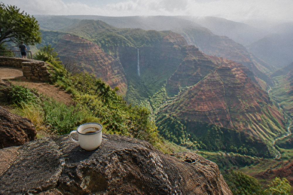
Waimea Canyon is the single most requested sight on Kauai after the Na Pali Coast, and it is the reason many visitors end up weighing a drive against a flight. The canyon stretches roughly 14 miles through the island's west side and reaches depths of up to 3,600 feet, figures the Hawaii State Parks page prints directly. Carved by the Waimea River and centuries of collapse along the faulted flank of the volcano, it exposes red, orange and green layers that shift color through the day.
The practical problem for a planner right now is ground access. After Hurricane Lowell in September 2026, the DLNR notice closed all Department of Land and Natural Resources lands on Kauai, including Kokee State Park, Kokee Road and Waimea Canyon Drive, and access follows DLNR notices. Nothing on this page should be read as a promise that the road, the lookouts or the park gate are open on your travel date. What remains true in every scenario is that the canyon itself has not moved, and a helicopter sees it from the air regardless of what the road below is doing. The 55-minute Safari flight from Lihue, the 50-minute Blue Hawaiian eco flight and the 45-minute Air Kauai doors-on family flight all route over the canyon, and this guide compares them below. If you would still rather try the road yourself, our guide to driving up Waimea Canyon covers the lookouts by mile marker, the entry fee for non-residents, and what the hurricane left behind on the route.
How Big Is Waimea Canyon State Park?
Waimea Canyon runs about 14 miles long and reaches depths of up to 3,600 feet, per the Hawaii State Parks page, and the state park unit sits on Kauai's west side above the towns of Waimea and Kekaha. The island itself measures 552 square miles, so the canyon slices through a meaningful share of its western flank. The neighboring Kokee State Park sits higher up the same road, and one non-resident ticket covers both.
The name "Grand Canyon of the Pacific" is old and loose, but the comparison is not absurd. A 14-mile gorge cutting 3,600 feet down through oxidized basalt produces the same layered-wall effect that makes its Arizona cousin famous, at roughly a tenth of the scale. The color comes from iron in the exposed rock: fresh flows read dark, weathered ones read red, and the green bands are vegetation clinging to the wetter ledges.
The canyon's water engine is the Waimea River, which drains the huge rainfall catchment around the Alakai wilderness and Mount Waialeale, whose summit sits at 5,148 feet and averages around 450 inches of rain a year. That water is why the canyon keeps cutting, and it is also why the interior ridges are often the cloudiest part of any island flight. Pilots route around or through depending on the morning.
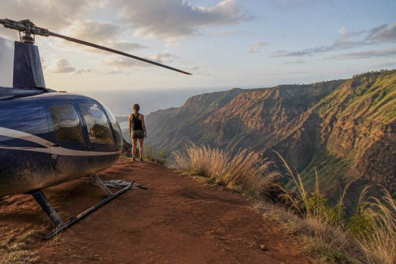
For scale on the ground side, the road from Waimea town climbs from near sea level to the Kokee uplands, past the lookout sequence described below. On the air side, a typical full-island flight from Lihue spends several minutes tracing the canyon's length, then swings out over the Na Pali Coast. Our Waimea Canyon helicopter tour guide covers the aerial routing in detail.
What Are The Main Lookouts And Mile Markers?
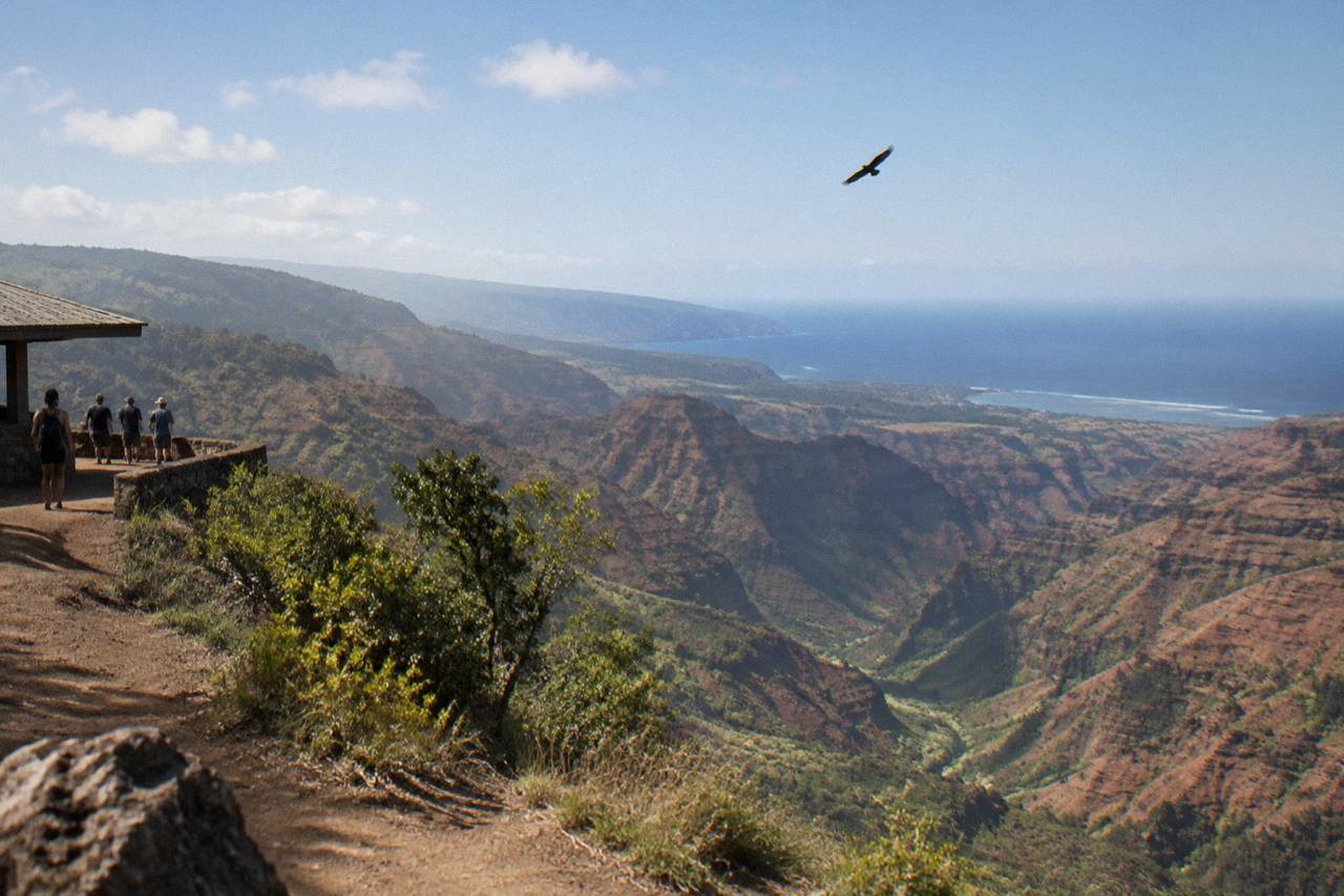
The four drive-up lookouts sit at mile markers 10, 13.5, 18 and 19 along Waimea Canyon Drive and Kokee Road: Waimea Canyon Lookout, Puu Hinahina, Kalalau Lookout and Puu o Kila. All are roadside pullouts reachable without hiking, when the road is passable. After the hurricane, the DLNR notice closed these park lands, and access follows DLNR notices.
The lookout sequence is the backbone of a canyon visit, and knowing the mile markers helps you plan fuel, timing and expectations. The two lower lookouts face into the gorge itself, while the two upper ones, Kalalau Lookout and Puu o Kila, look north over the Napali cliffs toward the coast from the Kokee side. On a clear morning the upper pair delivers the more dramatic view; when clouds pour over the ridge, the lower pair is the safer bet.
| Mile marker | Lookout | What it faces | Access style |
|---|---|---|---|
| 10 | Waimea Canyon Lookout | The main gorge and river channel | Roadside pullout |
| 13.5 | Puu Hinahina | Canyon layers and the Nomilo area | Roadside pullout |
| 18 | Kalalau Lookout | Kalalau Valley and the Napali cliffs | Roadside pullout |
| 19 | Puu o Kila | The Kalalau Valley rim and coast | Roadside pullout |
Two honest caveats apply to any plan built around that table. First, the DLNR notice of September 2026 closed these lands after Hurricane Lowell, with trees down across Waimea Canyon Drive and a roadblock at the Kokee Road junction, and the state said road clearing could take many more weeks. Never assume a lookout is reachable; check the DLNR notices for your dates. Second, even in normal times the upper lookouts sit in cloud more often than the lower ones, so a morning visit beats an afternoon one.
That cloud problem is exactly where a flight changes the math. A helicopter crossing the canyon at altitude sees the gorge from angles no pullout offers, including the waterfall notches on the north walls and the river's course at the bottom. The Na Pali Coast helicopter tour guide covers the coastal half of the same flight window.
If you are weighing the two ways of seeing the canyon, these are the three flights that route over it most directly:
Each of those departs from the Lihue area, none includes hotel pickup, and every one states free cancellation up to 24 hours before the start time. The Safari 55-minute flight includes all fees and taxes in its listed price, which is worth noting when comparing sticker numbers.
What Are The Entry Fees And Hours?
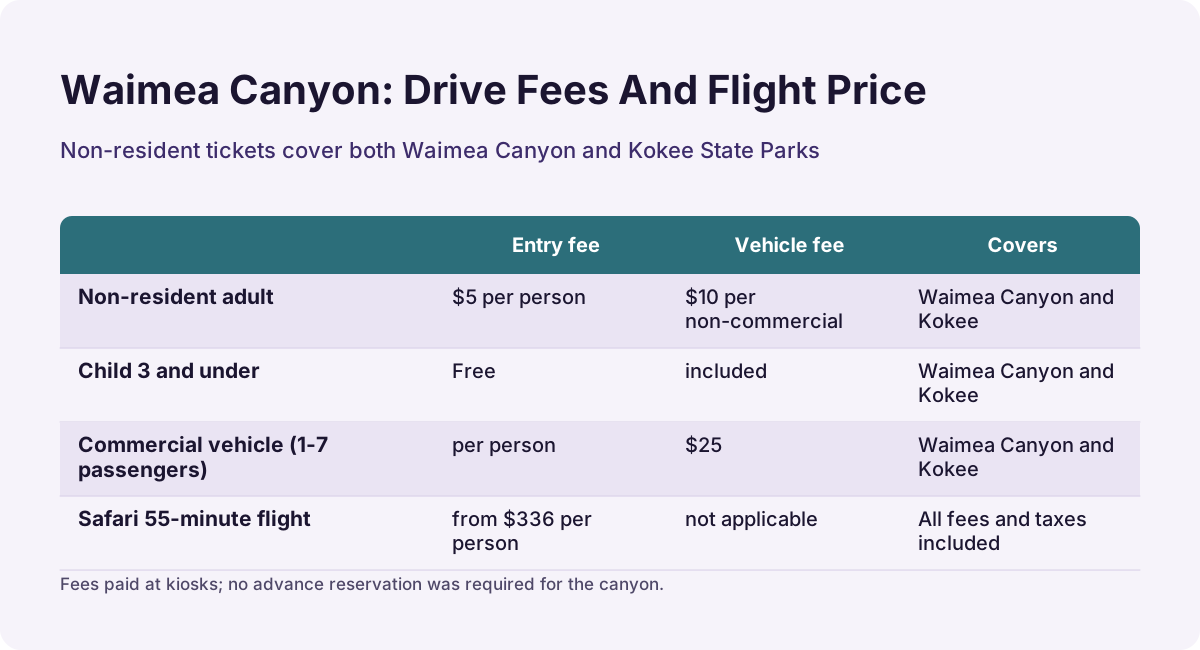
Non-residents pay $5 per person and $10 per non-commercial vehicle at Waimea Canyon State Park, children 3 and under enter free, and one ticket covers both Waimea Canyon and Kokee State Parks. Residents enter free with valid ID. Payment is at kiosks, and no advance reservation was required for the canyon, unlike Haena State Park on the north shore.
The fee structure is simple and worth knowing because it changes the arithmetic of a family visit. A car with two adults pays $20 total, and that ticket also unlocks the Kokee side up the same road, so most visitors do both in one drive. Commercial vehicles pay a different schedule, with non-resident commercial parking at $25 for one to seven passengers.
| Visitor type | Entry fee | Vehicle fee | Covers |
|---|---|---|---|
| Non-resident adult | $5 per person | $10 per non-commercial vehicle | Waimea Canyon and Kokee |
| Child 3 and under | Free | included | Same |
| Hawaii resident with ID | Free | Free | Same |
| Commercial vehicle (1-7 passengers) | per person | $25 | Waimea Canyon and Kokee |
Hours are the part no source pins to a single number, and the honest answer is that the park's day-use window follows daylight and staffing, with the state parks page carrying the current posted hours. What can be stated firmly: the DLNR closure after Hurricane Lowell suspended ordinary public access to these lands, and access follows DLNR notices. The fee schedule above is what the state parks page prints, and it is what you should expect to pay once the lands reopen to visitors.
The reservation contrast matters for itinerary planning. Haena State Park on the north shore requires advance reservations through its official system with no same-day sales, while the canyon side has historically been a drive-up, pay-at-the-kiosk experience. Our best time to visit Kauai guide goes deeper on how those two access models shape a week on the island.
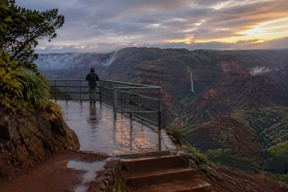
Because a fee-and-hours plan can collapse with one road closure notice, many visitors this season are putting the flight first. The Safari 55-minute flight over the canyon runs from $336 per person with fees and taxes included, and it carries 963 reviews at 4.8. One guest review on the listing sums up the aerial version of the view: "Amazing views of the island! Not as scary as I thought it would be. Enjoyed the pilot's narration of the scenery. And front desk staff were great. Helicopter sat 2 in front and 4 in the rear. There was some glare at times off our arms and legs - wearing darker clothing helps reduce this."
The box above links to the live listing, where dates, weights and current availability are confirmed at booking. Free cancellation up to 24 hours before the start time applies, and weather cancellations are rescheduled or refunded per the operator.
Is The Canyon Drive Open After Hurricane Lowell?
No promise either way can be made here, and that is the point: the DLNR notice closed all DLNR lands on Kauai after Hurricane Lowell, including Kokee State Park, Kokee Road and Waimea Canyon Drive, with fallen trees blocking sections and road clearing expected to take many more weeks. Access follows DLNR notices, so check them before planning the drive.
The storm's timeline is documented in the state's own releases. The DLNR notice of September 2026 stated that all department lands on Kauai would remain closed into the foreseeable future, with a 24-hour roadblock at the Kokee Road junction and crews facing weeks of clearing work. The same notice cycle confirmed that only Wailua River State Park had any limited reopening on the island. The notice closed these lands, and no reopening date has been announced.
What that means for a visitor is a planning rule, not a prediction. Treat the drive as unavailable until a DLNR notice says otherwise, and build a fallback. The canyon does not become invisible because the road is blocked; it simply has to be seen from the air. Reports after the storm said Lihue helicopter tours were flying with fewer slots than usual, so read the booking page early and expect date flexibility to matter.
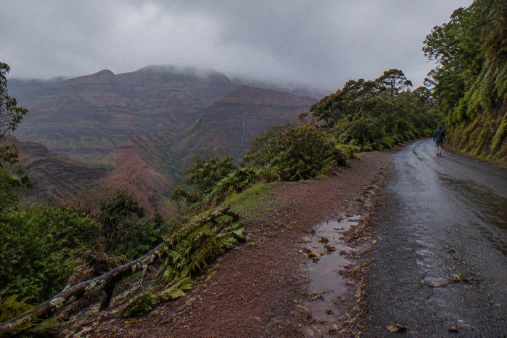
The air alternative also sidesteps the other chronic weakness of the drive: the upper lookouts cloud over. A flight that enters the canyon below or through the cloud line, then climbs to the Kokee side, shows both faces of the same weather. The 90-minute Safari canyon rim landing flight sets down on the rim of Olokele Canyon for a walk-around before continuing over Na Pali and Waimea Canyon, a landing the listing is explicit is at the canyon rim, not at Jurassic Falls. It carries 392 reviews at 4.8 and runs from $396 per person.
For readers comparing the drive and the flight on cost alone, the math is not close: $20 for a car of two versus hundreds per person for a shared flight. But the drive's cost assumes the road is passable, and right now that assumption fails. The is Waimea Canyon still closed blog post tracks the closure question directly, and the can you just drive through Waimea Canyon post answers the routing question for the day the road returns.
Which Helicopter Flights Go Over Waimea Canyon?
Every flight on this site's roster routes over Waimea Canyon except the 18-minute Heart of the Island tour, because it sits in the middle of the standard island loop: the 50-minute Blue Hawaiian eco flight, the 55-minute Safari flight, the 45-minute Air Kauai family flight, the doors-off flights and both private doors-off charters. Prices run from $221 to $579 per person depending on duration and format.
The canyon is the anchor of the island loop for a simple geographic reason: it is the biggest single feature between the west coast and the interior, and every full-island routing from Lihue crosses it. That means the choice between flights is not about whether you see the canyon but about how long you spend over it, what else the route includes, and whether the doors are on.
| Flight | Operator | Duration | From price | Rating and reviews |
|---|---|---|---|---|
| Blue Hawaiian 50-Minute Flight | Blue Hawaiian Helicopters | 50 min | $489 | 4.8 from 2,065 reviews |
| Safari 55-Minute, Fees Included | Safari Helicopters | 55 min | $336 | 4.8 from 963 reviews |
| Doors-On Family Flight | Air Kauai Helicopters | 45 min | $349 | 4.8 from 212 reviews |
| Princeville Departure, 45 Minutes | Blue Hawaiian Helicopters | 45 min | $579 | 4.9 from 34 reviews |
| Doors-Off, 50-Minute Flight | Air Kauai Helicopters | 50 min | $402 | 4.8 from 545 reviews |
| MD500 Doors-Off, 60 Minutes | Jack Harter Helicopters | 60 min | $460 | 4.8 from 425 reviews |
| Private Doors-Off, All Window Seats | Mauna Loa Helicopters | 55 min | $384 | 4.8 from 522 reviews |
A few patterns in that table deserve comment. The Safari 55-minute flight is the value anchor of the doors-on group: it covers more than 100 miles of central Kauai per its listing summary, and its printed price folds in fees and taxes, as most listings here do. The Blue Hawaiian eco flight is the most-reviewed tour on the roster at 2,065 reviews and 4.8, and one guest review calls it a "Must do experience, such a diverse island that can really only be appreciated by air." The Princeville departure is the only non-Lihue base on the roster, a 45-minute flight over Hanalei Bay and Na Pali in a cabin of up to four.
The doors-off column trades the cabin's climate and glass for open sides and a lanyarded phone as your only camera gear, per the Air Kauai listing. Weight and age policies differ operator by operator and are printed on each listing; the Kauai helicopter weight limits guide sorts those rules by operator so nothing surprises you at check-in, where every operator weighs passengers per FAA requirements.
The MD500 doors-off flight above carries at most four passengers plus the pilot, and one guest review on the listing describes it plainly: "We went in and out of canyons, gorges, seashores and mountains. What a breath taking view! This ride was the best activity I've done. You can see the whole island in an hour."
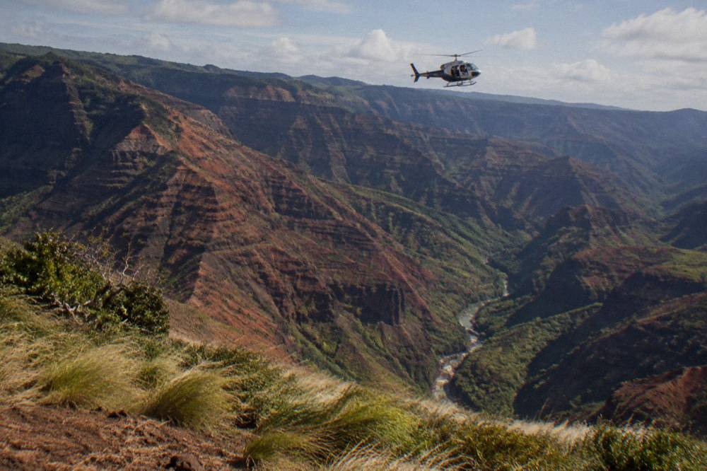
When Is The Best Time Of Year For Canyon Views?
Summer, roughly May through September, offers the most reliable conditions for both the drive and flights over Waimea Canyon, with clearer skies over the coast and interior valleys. Lihue's driest months on the 1991-2020 NOAA normals are June and July at 1.79 and 1.75 inches of rain, while March is the wettest at 5.61 inches. Mornings beat afternoons year-round.
The rainfall table below is the same data set the National Weather Service publishes for Lihue Airport, and it tracks what pilots and lookout visitors experience: the winter months pile up both rain and the interior cloud that hides the upper canyon. The trade-off is that winter rain is what keeps the falls running and the canyon walls green, so a wet-season flight trades some visibility risk for fuller waterfalls.
| Month | Lihue rainfall (in) | Average high (F) | Canyon view outlook |
|---|---|---|---|
| January | 2.78 | 78.6 | Mixed, falls running |
| February | 3.63 | 78.1 | Often cloudy interior |
| March | 5.61 | 78.5 | Wettest month, high cloud risk |
| April | 2.03 | 79.8 | Improving |
| May | 2.18 | 81.6 | Good |
| June | 1.79 | 83.3 | Excellent, drier |
| July | 1.75 | 84.6 | Excellent, drier |
| August | 2.33 | 85.2 | Very good |
| September | 2.18 | 85.3 | Very good |
| October | 3.27 | 83.9 | Mixed |
| November | 4.03 | 81.2 | Cloudier, falls strong |
| December | 4.64 | 79.1 | Cloudiest, wettest stretch |
Two footnotes keep that table honest. The canyon's own interior is wetter than Lihue's lowland station reading, because the mountains wring out more rain than the airport does; Waialeale's 450-inch average is the extreme end of that gradient. And the time of day matters at least as much as the month: operators' own FAQ pages say the time of day makes little difference to flight routing, while a local hotel recovery guide suggests morning slots for the calmest winds. Either way, the day's weather call belongs to the operator, and weather cancellations are rescheduled or refunded.
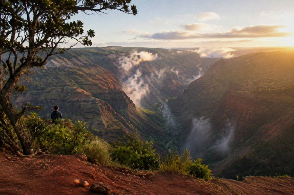
What Else Can You Do Around The Canyon?
Kokee State Park shares your entry ticket and adds upland forest trails and the Kalalau and Puu o Kila lookouts when accessible, while the towns of Waimea and Hanapepe sit below on the coast road. All Hawaii beaches are public, including the west-side strands near Polihale, though state park entry and parking are not free and access follows DLNR notices.
The one-ticket-two-parks arrangement is the best value move on the west side: the same $5 per person and $10 per vehicle covers the Kokee uplands, where the museum and the trail network sit, so a single day can run canyon lookouts in the morning and upland forest in the afternoon. Hanapepe, the west-side town with the swinging bridge and the Friday art walk, is a natural lunch stop on the route in from the south.
The free layer of the west side is real but bounded. Beaches are public under Hawaii law, and the free things to do on Kauai guide catalogs the no-cost options honestly, including where parking fees apply anyway. State park entry and parking are not free, and the DLNR closure after the storm applies to these lands as a set, so a "free beach afternoon" plan should not assume a canyon stop on the same day.
The paid layer is where the flight re-enters the picture. A private charter such as the Mauna Loa doors-off flight, which puts every passenger at a window seat and runs from $384 per person with 522 reviews at 4.8, turns the canyon into a private showing for your group rather than a shared cabin experience. The listing states life preservers are supplied and the maximum passenger weight is 275 pounds per person.
For a full comparison of shared versus private cabins, the private helicopter tour Kauai guide lays out the trade-offs, and Helicopter Tours Kauai keeps the full roster of verified flights with live prices and availability.
If you are ready to compare the three flights that route most directly over the canyon, the selection below is the shortlist:
Common Questions About Waimea Canyon State Park
How big is Waimea Canyon State Park?
Waimea Canyon stretches about 14 miles and reaches depths of up to 3,600 feet, per the Hawaii State Parks page. The state park unit covers the main gorge and connects up the same road to Kokee State Park, which your entry ticket also covers.
What does it cost to enter Waimea Canyon State Park?
Non-residents pay $5 per person plus $10 per non-commercial vehicle, children 3 and under are free, and residents with valid ID enter free. One ticket covers both Waimea Canyon and Kokee State Parks. Commercial vehicles pay a separate parking schedule.
Where are the Waimea Canyon lookouts?
The four drive-up lookouts sit at mile markers 10, 13.5, 18 and 19: Waimea Canyon Lookout, Puu Hinahina, Kalalau Lookout and Puu o Kila. All are roadside pullouts requiring no hiking, when the road is passable and the lands are open.
Is Waimea Canyon Drive open after Hurricane Lowell?
The DLNR notice closed all its Kauai lands after the September 2026 storm, with fallen trees blocking Waimea Canyon Drive and a roadblock at the Kokee Road junction, and the state said clearing could take many more weeks. Access follows DLNR notices, so check them before planning the drive; never assume the road is open.
Can you see Waimea Canyon without driving up?
Yes, from the air. Every helicopter flight on this site's roster routes over the canyon as part of the standard island loop from Lihue, including the 55-minute Safari flight from $336 per person with fees included and the 50-minute Blue Hawaiian eco flight from $489 per person. Flights see the canyon regardless of road conditions.
Do I need a reservation for Waimea Canyon State Park?
No advance reservation was required for the canyon side; payment is at kiosks. That contrasts with Haena State Park on the north shore, which requires advance reservations through its official system with no same-day sales. Check the DLNR notices for current access status on either side.